August to bring more rain and snow, but for farmers it’s ‘storm Lotto’
A wet August is forecast for most of mainland Australia, including inland regions that flooded earlier this year, potentially bringing relief to drought-affected farmers in parts of western NSW and Victoria.
Heavy rain stretching along the east coast, especially in NSW, will ease on Monday, but the weather bureau’s long-range outlook suggests the reprieve may not last long.

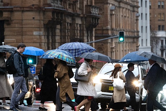
People crossing a Sydney CBD street in the rain on Thursday.Credit: Louise Kennerley
The Bureau of Meteorology believes there is a 60 to 80 per cent chance of above-average rainfall for most of the continent, apart from the west and far south-east, for August to October, inclusive.
There is also a 50 to 70 per cent chance of the next few months being “unusually wet” – defined as rainfall in the top 20 per cent of comparable periods – especially west of the Great Dividing Range.
Bureau senior climatologist Hugh McDowell said the current rain event stretched from Queensland to south-east Victoria, with NSW bearing the brunt.
On Saturday, the NSW State Emergency Service had several flood warnings for rivers in northern NSW, including possible moderate flooding that could close local roads at the Peel River in Tamworth and the Namoi River in Gunnedah. Half a metre of snow had fallen near Armidale and Guyra, a rare depth for those areas.
The weather bureau had previously predicted a warm, wet winter, especially in August. McDowell said climatologists were even more confident of a wet August now.
One reason was that five out of eight international models forecast the Indian Ocean Dipole to move from neutral to negative phase, McDowell said, a phenomenon usually associated with rain in Australia. The El Nino Southern Oscillation, a similar climate driver located in the Pacific Ocean, was also neutral, with some models predicting a La Nina to form.
“There’s that plus above-average sea surface temperatures in the Tasman and around much of Australia,” McDowell said. “That gives you more heat and moisture in the atmosphere, and more fuel for rain.”
McDowell said the east coast had average or warmer than average temperatures in June and July, while some regions around Canberra, the NSW mountains and inland, had minimum temperatures below average.
Rainfall was average to above-average in many areas, he said. Weatherzone has reported that South Australia had its wettest July in 27 years.
However, McDowell said it had not been enough to break the drought in the region that borders Victoria, NSW and South Australia.
National Farmers Federation president David Jochinke, a crop grower in Victoria’s Wimmera region, said the rainfall outlook was like “storm Lotto” for farmers because rain forecast for a region might not fall in a particular locality. He said most drought-afflicted areas had received a “touch of wet weather” over winter so far, but needed a favourable spring as well.
“Droughts are events that take a long time to compress a farming business or community into a stress situation, but they also take a long time to unwind,” Jochinke said.

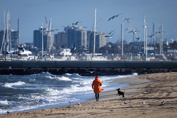
Cold and windy weather on the St Kilda foreshore in June.Credit: Paul Jeffers
McDowell said Australian temperatures had risen by about 1.5 degrees since national record keeping began, and this was expected to continue as the world warmed. The 2024 State of the Climate report also identified a reduction in cool season rainfall across southern parts of Australia, he said.
“Potentially, climate change could be exacerbating things like the recent drought we’ve seen across the south,” McDowell said.

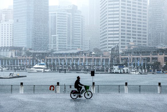
Heavy rain at Darling Harbour in Sydney earlier this week.Credit: Steven Siewert
After several poor seasons, ski towns in the Australian Alps are enjoying decent snow.
Mount Hotham in Victoria had a snowpack of 1.23 metres, its deepest July reading in a decade, Weatherzone reported. Last week Snowy Hydro also recorded a snow depth of 1.7 metres at Spencers Creek, at an elevation of 1830 metres, roughly halfway between the two largest NSW ski resorts Perisher and Thredbo.
Olivier Kapetanakos, a Jindabyne tourism business owner and president of the town’s chamber of commerce, said last year the snowpack only reached 1.3 metres. This year there had been regular snow dumps, though the cost-of-living crunch meant tourist numbers were still below 2022 and pre-COVID times.

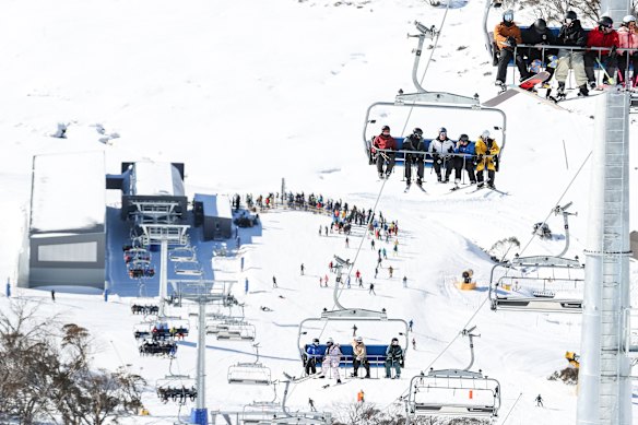
Skiers and snowboarders on the new chairlift at Mount Perisher in June.Credit: Alex Ellinghausen
James Stuart, founder of Queensland-based consultancy Climate Resilience and a former hydrologist at the Bureau of Meteorology, said inland Queensland and NSW still had full rivers making their way to Lake Eyre and waterlogged soil.
“I went out myself recently – it’s beautifully green, so that tells you that there’s a lot of water around,” Stuart said.
“Any more rain will make it easier for runoff to occur. Whether that means floods or not depends on the speed with which we get rainfall.”
Get to the heart of what’s happening with climate change and the environment. Sign up for our fortnightly Environment newsletter.